FOEL FRAS SUMMIT.

FOEL FRAS SUMMIT.

Tuesday 20 September 2011

#47.WAUN Y LLYN GREEN LANE.19-9-11.

Had a spare hour and wanting to check out a local lane i headed up to the Waun y Llyn Country Park on a cold clear morning.I was at the summit cairn just after 8 o'clock,below is the view across the Cheshire Plain with a weather front moving across.

The photo's are dark but i wanted to catch the weather front,below you can make out Beeston Castle and the Peckforton Hill's in the distance,right of photo.

Walking past the Llyn i made my way to the far end of the country park.

With a distant view to Moel Famau.

I now left the park and followed the green lane back to the main road.


On the many occasion's i have walked in the park i alway's look down on a derelict house and think to myself i would like to get a closer look at it,the lane run's past the house so today i got that chance.A big lottery win will see me buying this property and doing it up.

On the lane below me to my right i could make out a building/wall so i found a way down into the field and was pleasantly surprised to discover an old limestone kiln.

The walk today was 1.5 mile long with 200 feet of ascent.


MILEAGE        335
ASCENT         76.700
TOPS              82.

Sunday 18 September 2011

#46.CAERGWRLE CASTLE.18-9-11.

Me and Julie had been decorating my mum's house for a few day's and finished today so with the weather being nice and sunny decided on a little local walk so we drove to Caergwrle and had a walk around the village.It was 3pm when we parked up in the village car park.Turning right out the car park and crossing the A541 by the Ye Old Castle Inn we took the new path up to the castle.The old path was in a very poor state being eroded badly,overgrown with brambles/weeds and rutted.

Old path.

New path.

Some tree's have been thinned out enabling a decent view back down into Caergwrle and of Hope Mountain.

The ruin's of Caergwrle Castle are soon reached.


Julie standing up against the wall to show how thick it is.

From the castle we took the rear path that drop's down to the A550 and it's lovely bridge that span's the Afon Alyn.

From here we returned to the village via the ancient packhorse bridge.


Today's walk was 1.5 miles long with 250 feet of ascent.


MILEAGE      333.5
ASCENT       76.500
TOPS            81.

Monday 12 September 2011

#45.MOEL GWY.9-9-11.

Today's walk saw us driving to Llanarmon yn Ial at 3.30pm when Julie had finished work.After speaking to the landlord of the Raven public house we parked in their car park.

Leaving the village we picked up a green lane and headed for Moel Llanfair.

Looking across to Moel Gwy.

45 minutes after leaving the car we were stood oat the summit of Moel Gwy.

Looking across to Moel Famau.

Heading back to the village.

The limestone cliffs of Bryn Alyn.

2 hour's after we set off we were back at the Raven where we got washed and changed and had a fish and chips supper.We walked 4.5 miles today with 1,000 feet of ascent.


MILEAGE            332
ASCENT             76,250
TOPS                  81.

#44.SUGAR LOAF.4-9-11.

Me and Julie stayed in a b+b in Llanwrtyd Wells and made the short drive to walk up Sugar Loaf,a small mountain that has been on my to-do list for year's after passing it several times down the years on our visit's to South Wales.
Red Kite Statue in Llanwrtyd Wells.

Afon Irfon.

Parking at the picnic site it is it is only a half mile walk with 250 feet of ascent from the car and back.


MILEAGE        327.5
ASCENT          75,250
TOPS               79.

#43.Brecon Beacon's.3-9-11.

13 month's after completing my Welsh Nuttall's my great friend Howard Smith was set to complete them with his final 4 in the Brecon Beacon's.After putting the walk on the Walking Forum and a few personal messages we managed to assemble 19 hardy walker's to celebrate his completion.The weather forecast was not very encouraging,cloudy and dry morning with rain in the afternoon but im glad to say nobody was put off and we assembled at the Storey Arm's car park on a bleak saturday morning.Everybody suited and booted most left their rucksack's in their car's as the first mountain of the day was a there and back ascent of Y Gyrn.

That's Fan Fawr in the distance,our second mountain we were to climb today.

Looking down the Taf Valley to the Beacon's Reservoir.

Y Gyrn is only 1 mile from the car park with a 600 foot ascent,this is it's summit.

We returned to the car park and grabbed our bag's and started the ascent of Fan Fawr.

Frequent stop's were taken on it's steep ascent as we gained 1,000 feet in 1 mile to reach it's summit.


The final 100 metres saw us enter the cloud line and it started to rain.We didn't get any view's until we descended the final mountain and it didn't stop raining all day.Summit photo below.

We had a 2 mile bog trot now to reach Craig Cerrig-gleisiad,it's tiny summit hard to find in the mist.

The team now started to string out and i couldn't keep tabs on the front marker's and they started heading in the wrong direction toward's Nant Cwm Du.Realising we were going the wrong way i mentioned to Julian that we were following the wrong fence and he had seen the gate we should have passed through so we doubled back to it and were soon back on track,no harm done and less then 1 mile was walked in the wrong direction.The final step's to the summit of Fan Frynych and Howie's 190th and last Nuttall saw the team form a guard of honour for him to pass through.


By now we were all hungry so descended a little way to try to find some shelter to have our dinner.Me,Howie and Julian had brought champagne to celebrate his achievement.

We now walked down to the A470 which we crossed and made for the drover's road which we followed for 1.5 miles back to the car.Heading for the Afon Taf.


After changing at the car's we headed to the Tai'r Bull in Libanus for a celebratory drink.

Today's soggy walk came in at 9 mile with 2,500 feet of ascent.


MILEAGE        327
ASCENT         75,200
TOPS              78.

Friday 2 September 2011

#42.The DYFI HILL'S.27-8-11.

The last time i walked these hill's i did a circular route and i said to myself that i'd like  to do a linear walk next time as i missed a good section of the hill's out because i had to return to my car.Julian got in touch with me and asked if we were available for a walk here so i suggested the linear walk and he said yes to it,so we met Julian and Deb at the disused petrol station in Minllyn where i left my car and we drove up to Bwlch Oerddrws in Julian's.The weather forecast was not brilliant,possible rain shower's and a good deal of sun,as it turned out it was a little bit of sun and a good deal of rain,in fact we walked for 8 hour's and i reckon it rained for about 7 of them! Hey ho,never mind.
    It was straight into the wet gear from the off...........

..........and up the steep flank of Craig y Bwlch.

We were soon into the low cloud and zero visibility and we quickly made the summit of Cribin Fawr.

It had stopped raining here but was very windy,i was wearing a baseball cap to keep the rain off my glasses and as Julian pointed and said the mist is clearing i turned my head and the wind blew my hat about 15 metres away,luckily the summit is flat and it landed on the grass.I'm glad we weren't by any of the edges that we walked near later on as i wouldn't have seen it again.As we left the summit the cloud parted and left us with great view's for the rest of the day.Looking up to Waun Oer.

Leaving Cribin Fawr.

And looking across to the forest track we were to take later.

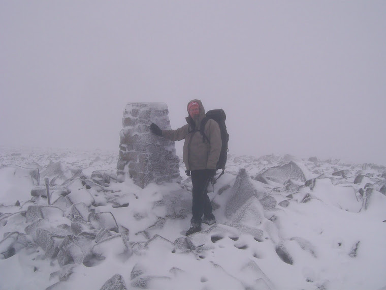
Julie was struggling with her asthma and didn't fancy the steep climb up to Waun Oer,so with us having to return to the bwlch after bagging it she decided to wait for us to return.Me at it's summit.

The sun made a brief appearance here and i contemplated taking my wet gear off but i looked down the valley and fast approaching was the next dollop of rain so i left it on.By the time we had returned to the bwlch it was pouring down again,we found a little shelter in the forest for a quick cup of tea and something to eat.

The forest track.

The steep ascent up to Craig Portas had badly eroded since i was last here and it was a difficult ascent on the slippery bare rock.

A pleasant 1.5 mile walk now took us up onto the bulk of Maesglase and the summit of Maen Du.


Last time i was here i returned to my car via Maen Du's steep north face and missed out on walking along Craig Maesglase and seeing it's waterfall,but not today.


We had our dinner at the top of the waterfall before heading for Bwlch Siglen.My radar malfunctioned here for a while and i took us the wrong way,sorry chap's.Getting back on track it was a very steep descent down Bwlch Siglen and up to Foel Dinas.


A little detour from the path to grab a geo-cache by the remain's of the quarry winding gear.

We then walked down to the disused Minllyn slate mine for a look around.


A pleasant path through the tree's took us back to my car before we drove back up to the "Bwlch" to retrieve Julian's car.We then drove to the Brigands Hotel in Mallwyd for a pint.

We walked 10 mile today with 3,350 feet of ascent.


MILEAGE      318
ASCENT       72,700
TOPS            74.